Commodity Blog
Aug 25 2021
Webinar Recap: Weather Market Outlook, plus the latest updates from cmdty by Barchart
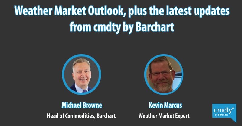
Yesterday we hosted an exciting live webinar with Barchart’s Head of Commodities, Michael Browne, and weather market expert, Kevin Marcus. If you attended, we hope you enjoyed the webinar! If you weren’t able to attend we’ll fill you in now!
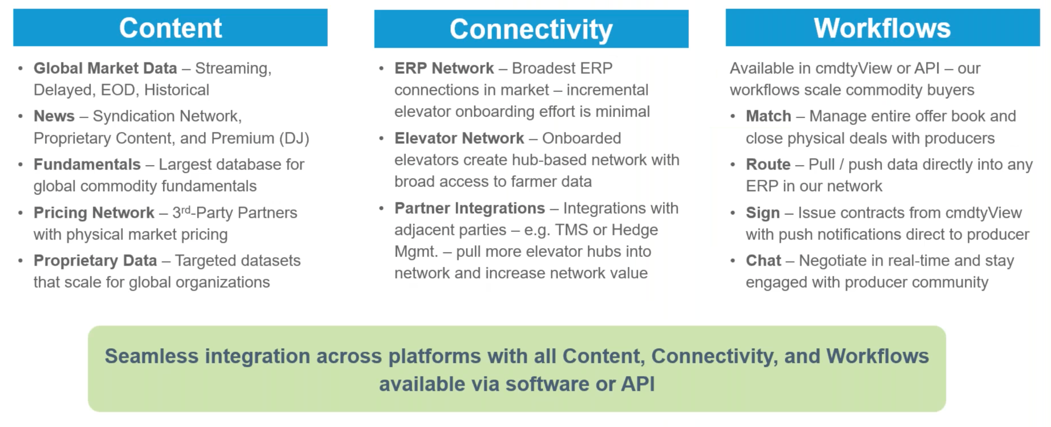
Michael kicked off the webinar by giving us an overview of the solutions we offer that help agribusinesses grow their reach and drive results. The top solutions we offer include cmdtyView, Marketplace, and content management.
Michael refers to cmdtyView as the one-stop shop for grain merchandisers. Marketplace is our fully branded app which we provide to grain elevators so they can provide it to their farmers. This provides them with all the information they need and with connectivity to their merchandiser. We also provide content management to grain elevators. This could mean managing their cash grain bids, publishing content to their website and their mobile app, and so on.
He then explains that our entire suite of solutions is pretty much powered by three things: content, connectivity, and workflows. The image below might give you a better idea of what each category contributes to our offering.
After Michael gave an in-depth overview of the latest updates from cmdty, Kevin took over to fill us in on the weather market.
He begins by telling us about the potential impacts of the highly likely La Nina upcoming in the next 3-5 months. This could cause very dry harvest weather in October for the U.S., except for tropical storm rains, which is a wild card. We can also expect dry fall growing conditions for the Southern Plains (after early September rain) and also for the Black Sea region.
There will be a slower start to rains in Brazil - which could delay the crop calendar by 2 to 4 weeks, similar to last year. These delays would cause on average an 11% decline in 2022 safrinha corn yield potentials vs. trend. La Nina would also cause drier conditions for wheat in Argentina, which may induce replant to corn for 5-10% of the 6.5m harvest acres projected. Conversely, it will be wetter for most of Australia, meaning a record yield is possible.
Kevin then went over the September to October 2021 weather outlook, including the fact that that tropical storm tracks are possible through the Mississippi Valley, through the Carolinas, and up the East Coast.
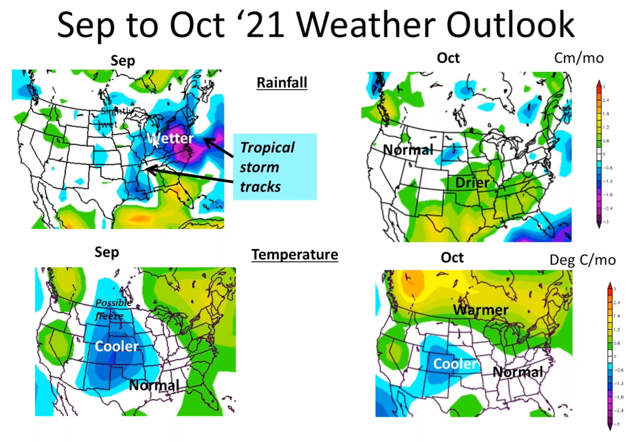
He then looks at where these hurricane tracks are going to steer. He predicts that they will shift West of the Bermuda high pressure. This increases the risk of major hurricane storm tracks for South and North Carolina. We should be primed for a number of storms over the next 30-40 days.
After discussing hurricane tracks, Kevin wanted to point out why we are seeing such extreme weather, and it’s because the warmest water in the ocean is currently sitting North, outside of the tropics. He explains that stronger SST temperature anomalies outside of the tropics, plus low solar activity favors the more extreme, higher amplitude ridge/trough pattern.
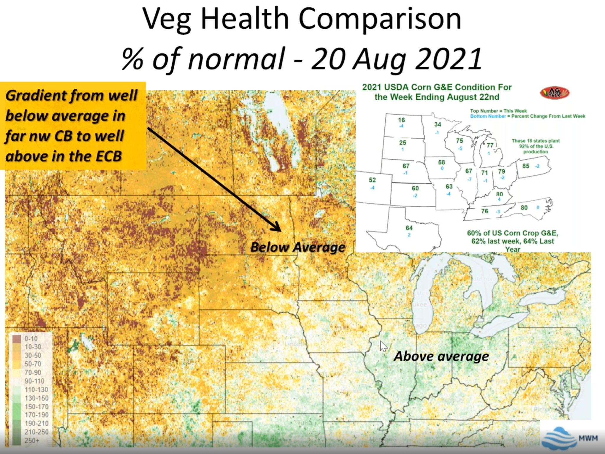
Kevin then goes over rainfall since May 2021 with highly dry conditions spreading across the Pacific Northwest, into Missouri, and up to Minnesota, which has had a very dry spring/summer.
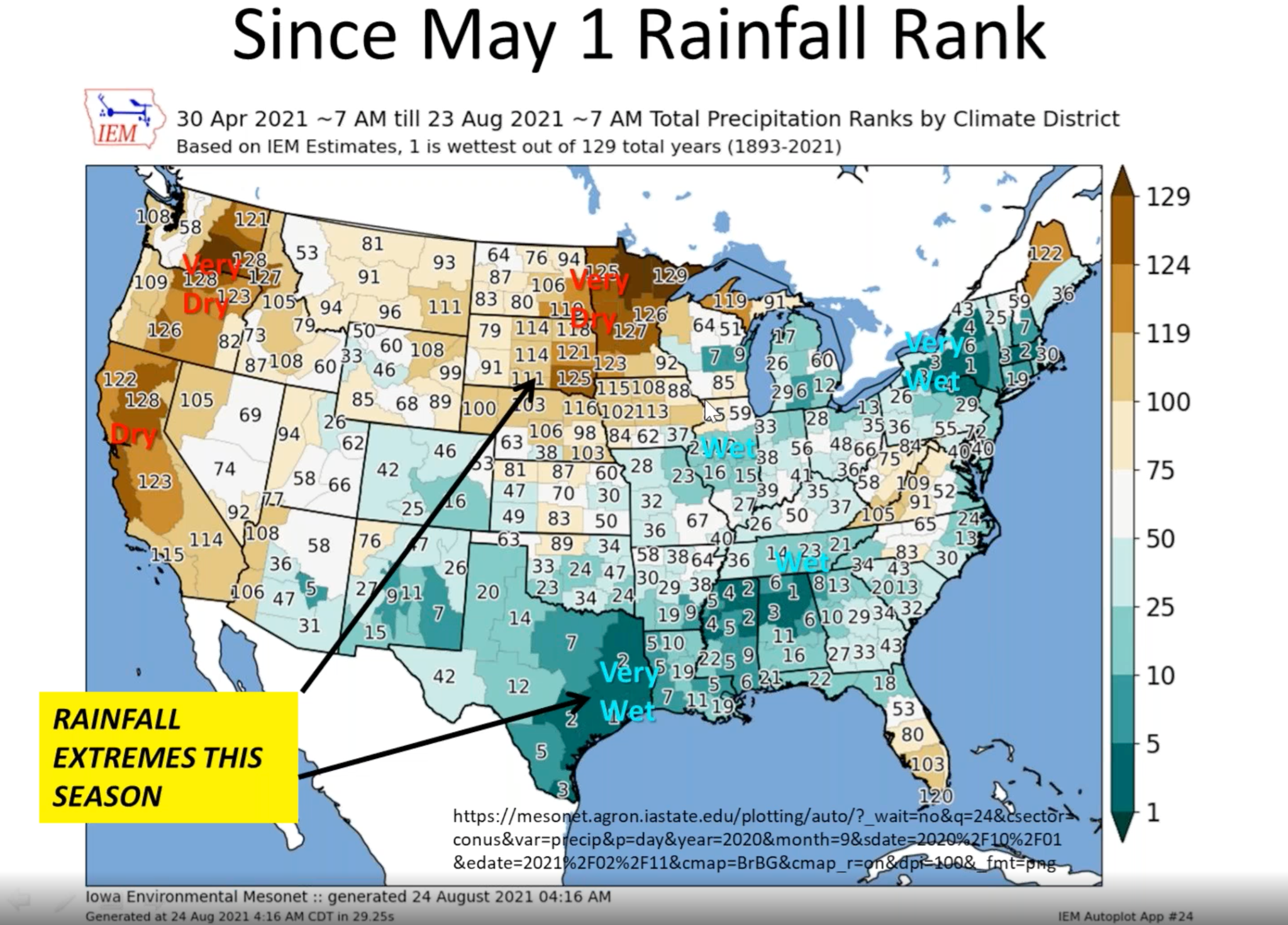
As a result of those dry conditions in the Dakotas and Minnesota, we will see a lot of areas lacking in crops, but Kevin does show a map pointing out the greener areas of the U.S. that aren’t normally so fruitful.
Kevin finishes up by filling us in on the updated corn and soybean yields for the U.S. in 2021 and 2022 before moving into a Q&A where Michael and Kevin answer many interesting questions. Michael and Kevin covered A LOT of ground in this webinar, and this blog merely scratches the surface. To get a more in-depth look into the current outlook of the weather market, watch the full webinar here. To learn more about the solutions available from cmdty, please visit our website.
Barchart Updates